The Fimmvorduhals hike is without a doubt one of the most popular amongst both locals and travelers alike.
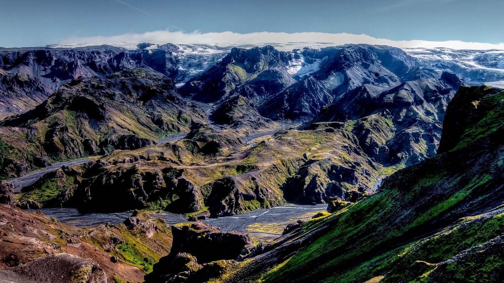
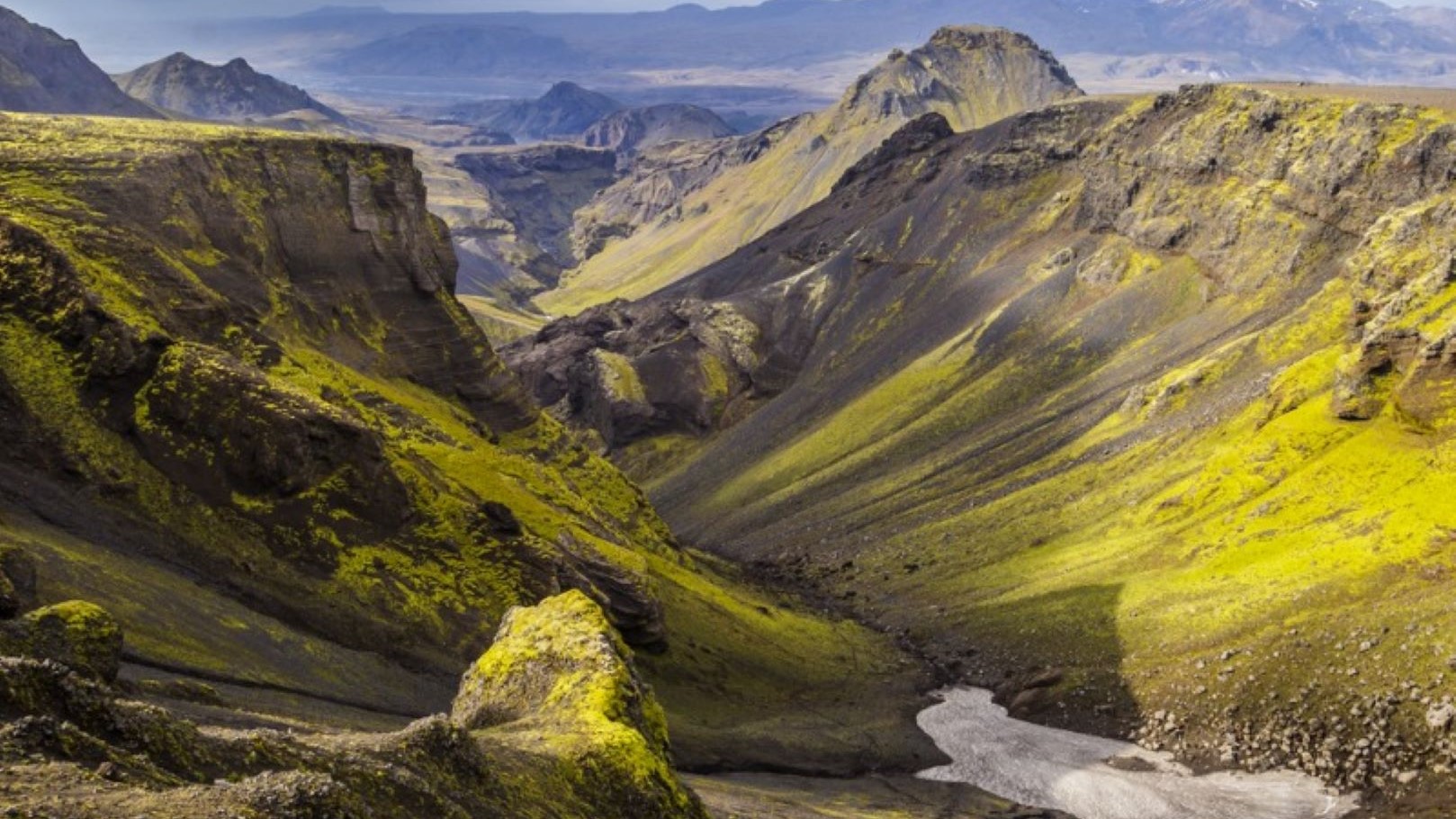
Hike between the world famous Eyjafjallajokull glacier volcano and Myrdalsjokull glacier, mountains, lava fields, historic sites, 26(!!) waterfalls , the newly formed volcanic craters Magni and Modi (from the 2010 Eyjafjallajokull eruption) and stunning nature in the Icelandic highlands.
If it sounds like a lot that’s because it is.
Quite simply scenery that is out of this world that no nature enthusiast should miss out on.
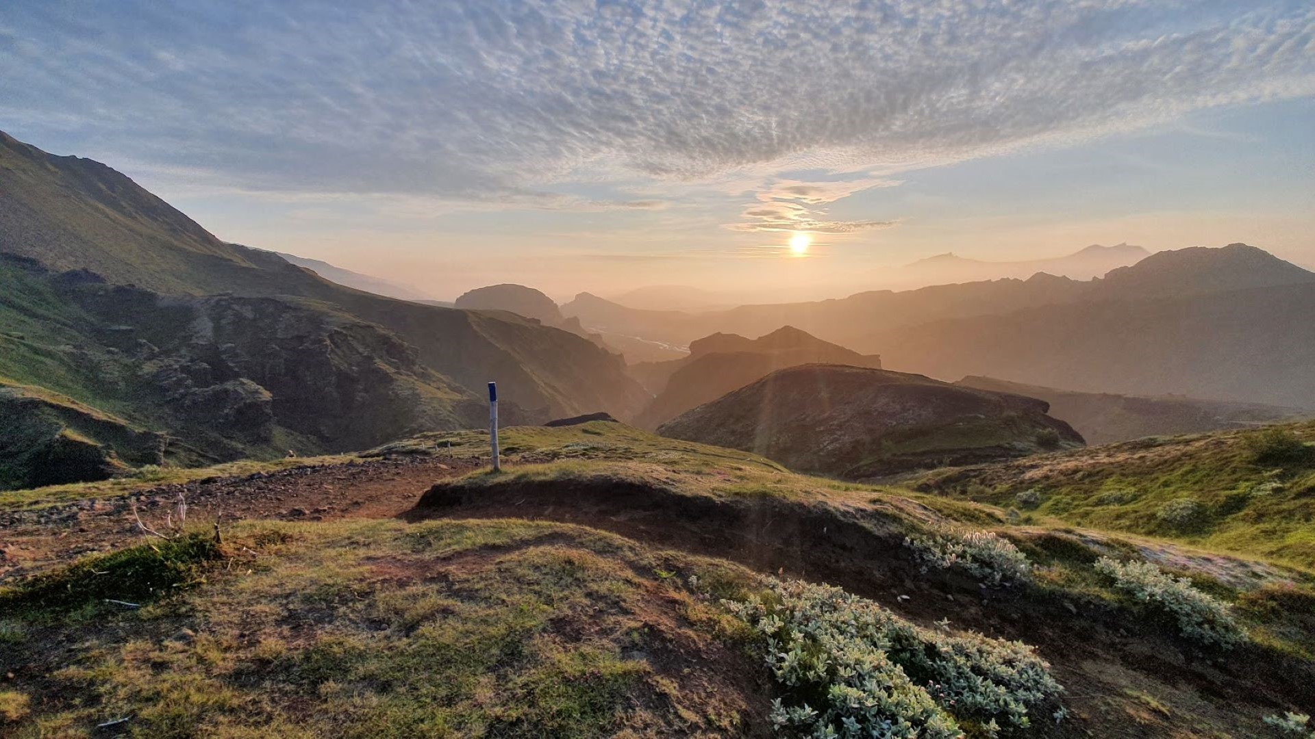
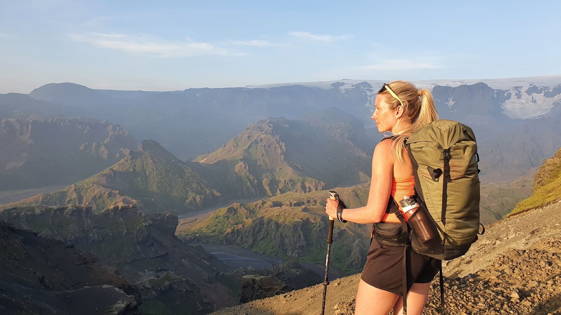
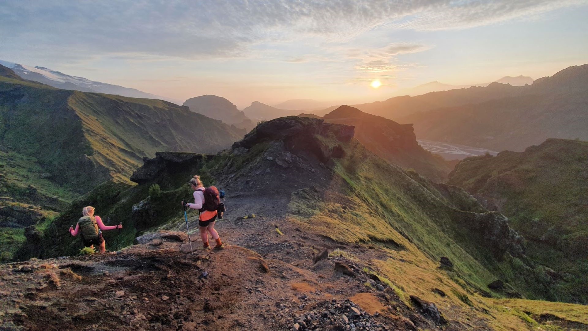
This hike will take you from the iconic Skogafoss waterfall to Thorsmork (named after Thor the God of Thunder) through 25 km of the most powerful and moving landscape Iceland has to offer.
The name Fimmvörðuháls can be broken down into the two words: ‘Fimm’ meaning five and ‘vörður’ meaning cairns. Icelanders used to mark paths by piling rocks in these so-called cairns. This is how they could tell that they were going in the right direction! Therefore, the name Fimmvörðuháls tells you about the 5 cairns you need to keep an eye out for in order to ensure you’re also headed in the right direction. Icelanders always put a new rock into the cairn every time we pass as a way to say thank you to the others that helped us as well as to help the ones that will hike after us, by making the cairn even more visible and we invite you to keep the tradition alive with us!
Camping is available in Thorsmork at the end of the hike but not included in the trip. In Thorsmork, which is itself an untouched paradise, we love having a big BBQ and reflect together on our challenging but amazing day. From there you can keep exploring, spend the night, go on to hike the Laugavegur trek (a multi day adventure) or grab the bus back to Reykjavik or Skogar.
29,900 ISK
This is a moderately fast paced group.
You can finish the hike and return from the end point in 1 day.
Available as add-on from BSÍ Bus Station
or Dalur Hostel (Reykjavik Camp Site)
9:45 AM from Skógar
No more than 10 Hours
25 km and approx. 1170 m elevation
15 miles and approx. 3850 ft
(English speaking)